


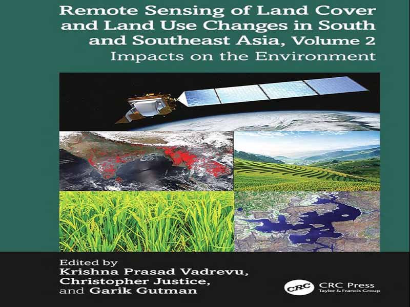
- عنوان کتاب: Remote Sensing of Land Cover and Land Use Changes in South and Southeast Asia, Volume 2, Impacts on the Environment
- نویسنده: Krishna Prasad Vadrevu
- حوزه: پوشش گیاهی
- سال انتشار: 2025
- تعداد صفحه: 331
- زبان اصلی: انگلیسی
- نوع فایل: pdf
- حجم فایل: 7.20 مگابایت
جنوب و جنوب شرقی آسیا مناطقی هستند که تحت تأثیر شهرنشینی، گسترش کشاورزی، جنگلزدایی، توسعه زیرساختها و سایر عوامل، شاهد تغییرات سریع پوشش و کاربری زمین (LCLUC) هستند. این تغییرات پیامدهای عمیقی برای تنوع زیستی، منابع آب، امنیت غذایی و تنظیم آب و هوا دارند و بر نیاز به استراتژیهای مؤثر نظارت و مدیریت تأکید میکنند. دادههای سنجش از دور در نقشهبرداری و نظارت بر LCLUC و تأثیرات آن بسیار مهم هستند. دادههای سری زمانی ماهوارهای اطلاعات با وضوح بالا را برای ارزیابی الگوهای کاربری زمین، تعیین کمیت میزان تغییرات و ارزیابی اثرات زیستمحیطی و اجتماعی آنها فراهم میکنند. علاوه بر این، نقشههای مشتق شده از سنجش از دور میتوانند برای مطالعه محرکهای پشت LCLUC، مانند رشد جمعیت، فعالیتهای اقتصادی و تغییرات سیاستی، مورد استفاده قرار گیرند و امکان توسعه راهحلهای مبتنی بر شواهد را فراهم کنند. با ادغام سنجش از دور با دادههای میدانی و تکنیکهای تحلیلی پیشرفته، محققان میتوانند تعاملات پیچیده بین سیستمهای انسانی و طبیعی را بهتر درک کنند و در نهایت از مدیریت پایدار زمین و توسعه منطقهای حمایت کنند. مجموعه کتابهای دو جلدی – سنجش از دور تغییرات پوشش و کاربری زمین در جنوب و جنوب شرقی آسیا، جلد 1: نقشهبرداری و پایش و سنجش از دور تغییرات پوشش و کاربری زمین در جنوب و جنوب شرقی آسیا، جلد 2: تأثیرات بر محیط زیست – مجموعهای از مقالات متخصصانی است که در کارگاهها و جلسات مختلف ابتکار تحقیقاتی جنوب/جنوب شرقی آسیا (SARI، sari.umd.edu) که از سال 2015 در آسیا برگزار شده است، شرکت کردهاند. SARI یک فعالیت تحقیقاتی است که توسط برنامه تغییر پوشش/کاربری زمین (LCLUC) ناسا (lcluc.umd.edu) تأمین مالی میشود. SARI با هدف توسعه یک برنامه تحقیقاتی، آموزشی و ظرفیتسازی منطقهای نوآورانه، از سنجش از دور، علوم طبیعی و علوم اجتماعی پیشرفته برای پیشرفت علم LCLUC در جنوب/جنوب شرقی آسیا استفاده میکند. برای پرداختن به چالشهای LCLUC، SARI از یک رویکرد سیستمی استفاده میکند و جنبههای بیوفیزیکی و اجتماعی-اقتصادی سیستمهای زمین، از جمله تعاملات بین کاربری زمین و آب و هوا و روابط متقابل بین سیاست، حکومت و کاربری زمین را بررسی میکند. در طول دهههای اخیر، LCLUC در جنوب/جنوب شرقی آسیا به دلیل تأثیرات گسترده بیوفیزیکی و زیستمحیطی، از جمله آلودگی فرامرزی که بر کیفیت هوا و سلامت انسان تأثیر منفی گذاشته است، توجه بینالمللی قابل توجهی را به خود جلب کرده است. از طریق جلسات SARI، محرکها و اثرات حیاتی LCLUC در مقیاسهای محلی، منطقهای و جهانی شناسایی شدهاند و مسائل فوری نیازمند توجه فوری را برجسته میکنند. این مجموعه کتاب دو جلدی برای پاسخگویی به نیازهای تحقیقاتی و کاربردی جامعه LCLUC مفهومسازی شده است. هر سه ویراستار این جلدها، متخصصان مشهوری هستند که بهطور گسترده در مورد مطالعات LCLUC با استفاده از دادههای سنجش از دور ماهوارهای منتشر کردهاند. ما خوشحالیم که جلد دوم این اثر جامع را ارائه میدهیم که مجموعهای متنوع از مطالعات را گرد هم میآورد که نقش متحولکننده سنجش از دور ماهوارهای در LCLUC و تأثیرات آن بر محیط زیست را برجسته میکند. این کتاب به تعاملات پویا بین پوشش زمین، کاربری زمین و سیستمهای انسان-محیط زیست در سراسر جنوب و جنوب شرقی آسیا میپردازد و بینشهایی در مورد مسائل حیاتی مانند امنیت غذایی، کشاورزی، شهرنشینی و پایداری زیستمحیطی ارائه میدهد. این کتاب بینشهای حیاتی در مورد چالشهای زیستمحیطی، اجتماعی-اقتصادی و بهداشتی که امروزه منطقه را تعریف میکنند، ارائه میدهد. با ادغام فناوریهای سنجش از دور، دادههای ماهوارهای و بررسیهای اجتماعی-اقتصادی، هر فصل الگوها و روندهایی را که چشماندازها و معیشتها را در کشورهای جنوب/جنوب شرقی آسیا شکل میدهند، آشکار میکند و ماهیت پیچیده و وابسته به هم تغییرات محیطی را نشان میدهد. در فصل 1، میترا و همکاران عوامل مؤثر بر ناامنی غذایی در مناطق توسعه نیافته هند را بررسی میکنند و نقش شاخصهای اجتماعی-اقتصادی را در کنار دادههای کاربری زمین ماهوارهای برجسته میکنند. تجزیه و تحلیل آنها نشان میدهد که چگونه مالکیت داراییها و بازده خارج از مزرعه محرکهای کلیدی ناامنی غذایی هستند، در حالی که پوشش زمین و تغییرات کاربری زمین نقش کمتری دارند. این امر زمینه را برای تأثیرات گستردهتر زیستمحیطی مورد بحث در فصلهای بعدی فراهم میکند، جایی که تغییرات کاربری زمین بر امنیت غذایی و پیامدهای گستردهتر اجتماعی-اقتصادی و زیستمحیطی تأثیر میگذارد. دی و همکاران در فصل 2 تمرکز خود را به حوضه گنگ تغییر میدهند، جایی که گسترش شهری و تشدید کشاورزی تغییرات قابل توجهی در پوشش زمین در دو دهه گذشته ایجاد کرده است. آنها از طریق لنز سنجش از دور، پیامدهای این تغییرات، از جمله از بین رفتن زمینهای کشاورزی و رشد مناطق شهری را بررسی میکنند و تأثیر شهرنشینی بر تولید مواد غذایی را به مضامین گستردهتر زیستمحیطی در فصل 1 پیوند میدهند. این مطالعه همچنین یک روش جدید نقشهبرداری از حوضچههای پرورش ماهی ارائه میدهد که تطبیقپذیری سنجش از دور را در ردیابی مناظر پیچیده کشاورزی نشان میدهد و در نتیجه درک ما را از چگونگی استفاده از زمین و شیوههای مدیریت زمین میتواند تولید و مصرف مواد غذایی را بهینه کند.
South and Southeast Asia are regions undergoing rapid land cover and land use changes (LCLUC) driven by urbanization, agricultural expansion, deforestation, infrastructure development, and other factors. These changes have profound implications for biodiversity, water resources, food security, and climate regulation, underscoring the need for effective monitoring and management strategies. Remote sensing data is crucial in mapping and monitoring LCLUC and its impacts. Satellite time- series data provide high- resolution information essential for assessing land use patterns, quantifying the extent of changes, and evaluating their environmental and societal effects. Additionally, remote sensing derived maps can be used to study the drivers behind LCLUC, such as population growth, economic activities, and policy changes, enabling the development of evidence- based solutions. By integrating remote sensing with field data and advanced analytical techniques, researchers can better understand the complex interactions between human and natural systems, ultimately supporting sustainable land management and regional development. The two- volume book series— Remote Sensing of Land Cover and Land Use Changes in South and Southeast Asia, Volume 1: Mapping and Monitoring and Remote Sensing of Land Cover and Land Use Changes in South and Southeast Asia, Volume 2: Impacts on the Environment— is a collection of papers from experts who participated in various South/ Southeast Asia Research Initiative (SARI, sari.umd. edu) workshops and meetings held in Asia since 2015. SARI is a research activity funded by NASA’s Land Cover/ Land Use Change (LCLUC) Program (lcluc.umd. edu). SARI aims to develop an innovative regional research, education, and capacitybuilding program that leverages state- of- the- art remote sensing, natural sciences, and social sciences to advance LCLUC science in South/ Southeast Asia. To address LCLUC challenges, SARI employs a systems approach, examining both biophysical and socioeconomic aspects of land systems, including interactions between land use and climate and the interrelationships among policy, governance, and land use. Over recent decades, LCLUC in South/ Southeast Asia has attracted significant international attention due to its extensive biophysical and environmental impacts, including transboundary pollution, which has adversely affected air quality and human health. Through SARI meetings, critical drivers and effects of LCLUC have been identified at local, regional, and global scales, highlighting urgent issues requiring immediate attention. This two- volume book series was conceptualized to meet the research and application needs of the LCLUC community. All three editors of these volumes are renowned experts who have published extensively on LCLUC studies using satellite remote sensing data. We are pleased to present Volume 2 of this comprehensive work, which brings together a diverse array of studies that highlight the transformative role of satellite remote sensing in LCLUC and its impacts on the environment. This book delves into the dynamic interactions between land cover, land use, and human– environment systems across South and Southeast Asia, providing insights into critical issues such as food security, agriculture, urbanization, and environmental sustainability. It offers vital insights into the ecological, socio- economic, and health challenges that define the region today. By integrating remote sensing technologies, satellite data, and socio- economic surveys, each chapter uncovers patterns and trends that shape the landscapes and livelihoods in South/ Southeast Asian countries, illustrating environmental changes’ complex and interdependent nature. In Chapter 1, Mittra et al. investigate the factors influencing food insecurity in India’s underdeveloped regions, highlighting the role of socio- economic indicators alongside satellite- derived land use data. Their analysis shows how asset ownership and off- farm returns are key drivers of food insecurity, while land cover and land use changes play a lesser role. This sets the stage for the broader environmental impacts discussed in subsequent chapters, where land use changes influence food security and wider socioeconomic and environmental outcomes. Di et al. shift the focus to the Ganges Basin in Chapter 2, where urban expansion and agricultural intensification have driven significant land cover changes over the past two decades. Through the lens of remote sensing, they explore the consequences of these changes, including the loss of farmland and the growth of urban areas, linking urbanization’s impact on food production to the broader environmental themes in Chapter 1. The study also contributes a new fishpond mapping methodology, showcasing the versatility of remote sensing in tracking complex agricultural landscapes, thus furthering our understanding of how land use and land management practices can optimize food production and environmental health. In Chapter 3, Bhattarai et al. continue the environmental narrative by examining evapotranspiration (ET) to potential evapotranspiration (PET) ratios across India’s agricultural lands. This work extends the discussion on land and water management by focusing on water stress in different regions and the growing need for fine- scale monitoring. It directly connects to the findings in Chapter 2, where urban and agricultural land use changes increase water demand, highlighting the growing challenges of balancing land use and water resources amidst climate change. Chapters 4 and 5 focus on the forests of India. DeFries et al., in Chapter 4, explore the socio- economic drivers of forest transitions in Central India’s dry tropical forests, further connecting the dots between land use changes and environmental degradation. Their study links improving living standards to decreased forest degradation. This important finding echoes Chapter 1’s insights into how socio- economic factors, such as asset ownership and livelihoods, impact environmental outcomes. This emphasizes the interconnectedness of socio- economic development, land use changes, and ecological conservation. In Chapter 5, Fleischman et al. discuss how remote sensing can deepen understanding of human– environment interactions in South Asia. They highlight the limitations of current technology and its focus on forest cover, which often overlooks other values in nature. The authors argue for better research and policymaking, emphasizing transparency, understanding technological limitations, and integrating remote sensing with other research techniques to improve human wellbeing and nature conservation. Chapters 6 through 9 take the reader into urbanization and its environmental consequences. In Chapter 6, Dasgupta and Kumar’s study of thermal and ecological comfort in urban areas links directly to the earlier discussions on land use changes. Their findings on the relationship between land surface temperatures and urban development underscore how urban sprawl exacerbates environmental stress, particularly in heat- sensitive areas. This directly connects to Chapter 7, where McAvoy et al. uses nighttime satellite data to track urban sprawl’s impact on forests, revealing how development encroaches into once- natural landscapes, contributing to environmental degradation and increased human– environment conflict. Chapter 8, by Aithal et al., deepens the urban narrative by focusing on Bengaluru’s increasing heat stress, further elaborating on the consequences of land use changes for human health. The authors emphasize the need for urban planning strategies that mitigate the effects of heat stress, particularly in areas with high urban density. Chapter 9, by Joseph et al., is unique and focuses on the Indian Flying Fox bat and its roosting habitats. The study demonstrates how land use changes, particularly highway development and habitat degradation, directly impact wildlife and public health, emphasizing the interconnection between human development, environmental health, and zoonotic disease risks. This study highlights the need for conservation strategies to mitigate environmental damage and public health threats, tying the earlier discussions on land cover changes to a broader understanding of human– wildlife– environment interactions. Chapter 10 by Kotrike et al. explores the impact of aerosols on cloud lifetime and solar radiation reflectance in Southern India, where industrialization and urbanization have increased aerosol formation. The study analyzes the effects of aerosol optical depth (AOD) on cloud fraction (CF) and precipitation during the southwest monsoon from 2005 to 2019, finding a positive relationship between AOD and CF. Atmospheric stability significantly affects cloud formation in some thunderstorm states but not in more intense storms. Land cover changes, including increased cropland and urban areas, are linked to decreased precipitation, partly due to reduced evapotranspiration from urbanization. Chapters 11 through 16 focus on Southeast Asia, where LCLUC changes continue to pose significant challenges to the environment and human health. In Chapter 11, Hoffman- Hall explores the relationship between land use change and malaria transmission in Myanmar, showing how deforestation and human activity influence disease spread. Chapter 12, by Potapohn et al., introduces Thailand’s Actionable Intelligence Policy (AIP) platform, which integrates remote sensing data with ground- level information to inform public decision- making. This chapter demonstrates how remote sensing can be used to track environmental changes and facilitate more effective policy interventions, offering a concrete example of how technology can be applied to solve real- world environmental problems. Chapters 13 and 14 by Brown et al. and Kaewplang et al. use remote sensing to inform agricultural land use planning and crop yield forecasting in Vietnam and Thailand. Their work emphasizes how satellite data can be used to predict and manage agricultural changes, directly contributing to more sustainable agricultural practices and more efficient resource use. Thus, it connects back to the overarching theme of balancing land use, food production, and environmental sustainability. Chapters 15 and 16 focus on biomass burning. Sentian et al. (Chapter 15) established a biomass- burning emission inventory for the ASEAN region from 2013 to 2021 using remote sensing data to track emissions from burning activities, providing valuable data for mitigating biomass burning’s environmental impact. In Chapter 16, Shi et al. develop a high- resolution emission inventory for open biomass burning (OBB) in South and Southeast Asia from 2020 to 2022, revealing significant carbon emissions, primarily from forests and woodlands, along with seasonal variations in burning patterns. Their findings contribute to more accurate air quality models and regional emissions reduction strategies. Together, these chapters provide a comprehensive view of the impacts of LCLUC, including the dynamic interactions between land use changes, environmental health, socio- economic factors, and technological advancements. The studies demonstrate how remote sensing can be used to understand these impacts and complex interactions, offering insights that inform policy and practical interventions for sustainable development. The book presents a framework for addressing the region’s pressing environmental challenges through these interconnected chapters, emphasizing the need for integrated approaches that balance development, conservation, and public health. This volume will be valuable to anyone interested in remote sensing- based approaches for quantifying LCLUC’s environmental impacts. It will be especially useful for environmental scientists, geographers, ecologists, atmospheric scientists, and environmental professionals seeking to deepen their understanding of these impacts.
این کتاب را میتوانید از لینک زیر بصورت رایگان دانلود کنید:
Download: Remote Sensing of Land Cover and Land Use Changes in South and Southeast Asia, Volume 2


نظرات کاربران