

پست های اخیر
-
 دانلود کتاب برنامهنویسی همزمان، سیستمهای باز و روشهای رسمی
-
 دانلود کتاب برنامهنویسی شیءگرا با اشیاء ABAP
-
 دانلود کتاب فراابتکاریهای کوانتومی چندسطحی. کاربردها در کاوش دادهها
-
 دانلود کتاب ۱۰۰ سوال و پاسخ در مورد فشار خون بالا برای مبتدیان
-
 دانلود کتاب نابرابریهای هندسی و کاربردها
-
 دانلود کتاب مجوز پویا – کنترل دسترسی تطبیقی
-
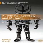 دانلود کتاب آدمکها، سایبورگها و جهشیافتهها: بدنهای عجیب و غریب از انسانگرایی تا فراانسانگرایی
-
 دانلود کتاب آموزشهای پیشرفته در مورد مدارهای کوانتومی
-
 پادکست صوتی انگلیسی به همراه متن (غلبه بر استرس)
-
 دانلود کتاب دویست و پنجاهمین کتاب همه کاره آمریکا برای مبتدیان
مطالب تصادفی ماه گذشته
-
 دانلود کتاب هوش مصنوعی و حقوق بشر، دموکراسی، و نقش قانون
-
 دانلود کتاب هوش مصنوعی برای مفاهیم علم شیمی، مدلها و کاربردها
-
 دانلود آهنگ فرانسوی Dreamin’ از Damien Lauretta با متن و ترجمه
-
 دانلود آهنگ فرانسوی Toi c’est moi از Dan Bigras و Laurence Jalbert با متن و ترجمه
-
 دانلود آهنگ فرانسوی Face à face از Dania Giò با متن و ترجمه
-
 دانلود آهنگ فرانسوی Tous les cris les S.O.S از Daniel Balavoine با متن و ترجمه
-
 دانلود آهنگ god save me از Machine Gun Kelly با متن و ترجمه
-
 دانلود آهنگ Golden God از Machine Gun Kelly با متن و ترجمه
-
 دانلود آهنگ GTS از Machine Gun Kelly با متن و ترجمه
-
 دانلود کتاب هوش مصنوعی از تخیلات علمی تا حقیقت


نظرات کاربران